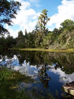
Shingle Creek Regional Park

Shingle Creek Regional Park is an urban oasis at the Headwaters of the Florida Everglades and is designated as one of "America’s Great Outdoors" by President Obama. Shingle Creek is comprised of multiple properties and parcels purchased through the conservation partnership efforts of Osceola County, City of Kissimmee, South Florida Water Management District, and Trust for Public Land and Florida Communities Trust. Additional parcels have been purchased through the Osceola County Environmental Lands Program formerly known as SAVE Osceola.
History
Shingle Creek has a rich history from a lifeline to the early inhabitants of Osceola County to the urban oasis present today. Referred to as the "Northernmost Headwaters of the Florida Everglades," Shingle Creek begins in Orlando and meanders 23 miles before flowing into Lake Tohopekaliga (Toho) in Osceola County. Water from Shingle Creek will make a 350 mile journey through the Kissimmee Chain of Lakes (KCOL), down the Kissimmee River and into Lake Okeechobee, before flowing out to the Everglades or the Gulf of Mexico.
The Florida Midland Railroad crossed Shingle Creek in 1890 and remained in effect until 1950, just south of present day US192, remnants of which can be seen while paddling along the creek.
To learn more about the natural history and culture of Shingle Creek, visit the Osceola County Welcome Center and History Museum at 4155 W Irlo Bronson Highway, Kissimmee, FL 34746. (407) 396-8644.
Experience
Today, Shingle Creek can be experienced by foot, bicycle or boat at multiple sites. The Shingle Creek Regional Trail is a multi-use trail through one of Florida's most traveled urban areas. When fully constructed, the 32 mile trail will extend from Kissimmee to Wekiva Springs State Park in Seminole County. Shingle Creek can be paddled for approximately 2 miles from Babb Landing in the north, with an alternative access point at Steffee Landing.
Amenities
- Bird watching
- Biking
- Fishing
- Paddling
- Picnicking

